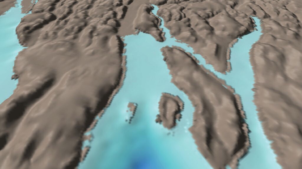
プロジェクト開始時点(2017年8月)に公開されていた海底地形図:グリーンランド北部に位置するライダー氷河
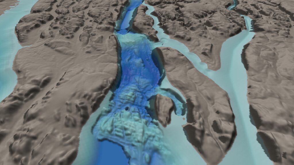
今回公開した2020年版の海底地形図:同所
日本財団:世界の海底地形図公開:GEBCO Seabed 2030(動画):
Nearly One-Fifth of World’s Ocean Floor Now Mapped:
日本基金会:已发布的世界地形图:GEBCO海底2030
日本財団:
2020.06.21
「日本財団-GEBCO Seabed 2030」:
始動から2年10カ月 。
地図化された世界の海底地形は、6%から19%へ拡大しています。
6月21日 は、国際水路デー。
2020年版の世界の海底地形図を公開、科学的解明も進んでいます。
日本財団は、海洋事業の一環として、2017年8月から2030年までに全地球の海底地形図を100%完成します。
「GEBCO Seabed 2030」
海底地形の解明が進むことで、海底に残された痕跡によって「氷河の融解が太古からどのように進んできたか推測できること」も判明しました。
本件は2020年5月29日に科学雑誌『Science』に掲載。
日本財団
https://www.nippon-foundation.or.jp/who/news/pr/2020/20200621-45287.html
Nearly One-Fifth of World’s Ocean Floor Now Mapped
On the occasion of World Hydrography Day, The Nippon Foundation-GEBCO Seabed 2030 Project, which aims to map the entire global ocean floor by 2030,
has announced the inclusion of 14.5 million square kilometers of new bathymetric data in the latest GEBCO Grid.
Nearly one-fifth of the world’s ocean floor has now been mapped, with the new data equating to an area twice the size of Australia.
Over the past year, coverage of the seabed
has risen to 19% from 15%. When Seabed 2030 was launched in 2017, only 6% of the oceans had been mapped to modern standards.
The effort to complete the map of the world’s oceanshas gathered significant momentum since its launch, with Seabed 2030 rallying over 100 international organizations in support.
The Project
now has 133 official partners, contributors and supporters, and continues to pursue new collaborations in data collection and technical innovation.
The Nippon Foundation
https://www.nippon-foundation.or.jp/en/news/articles/2020/20200621-45318.html