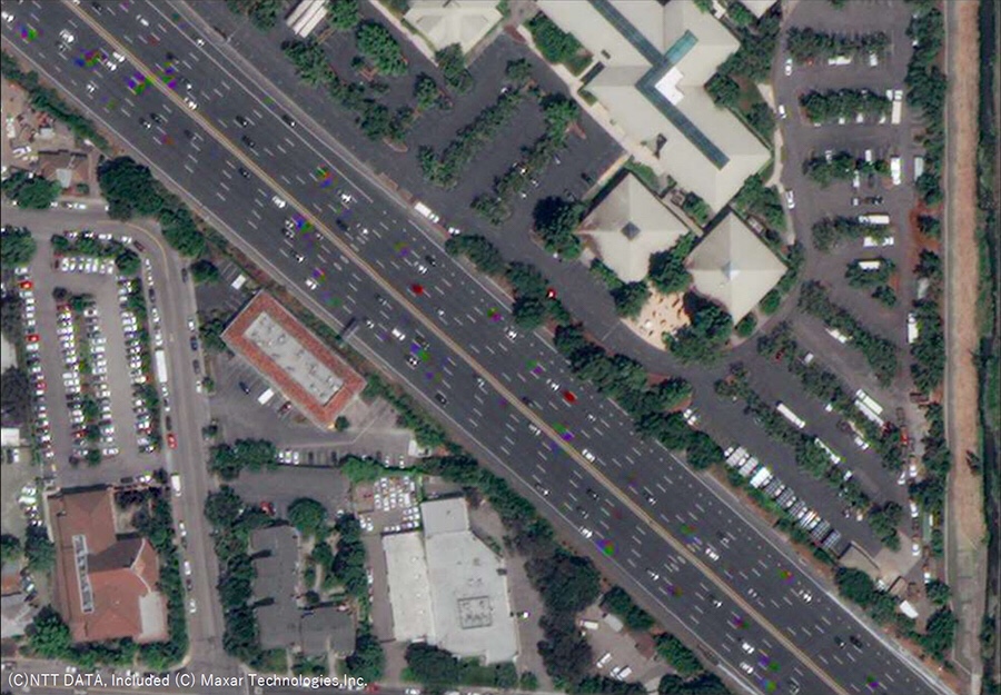
Figure 1. Satellite image (overseas)
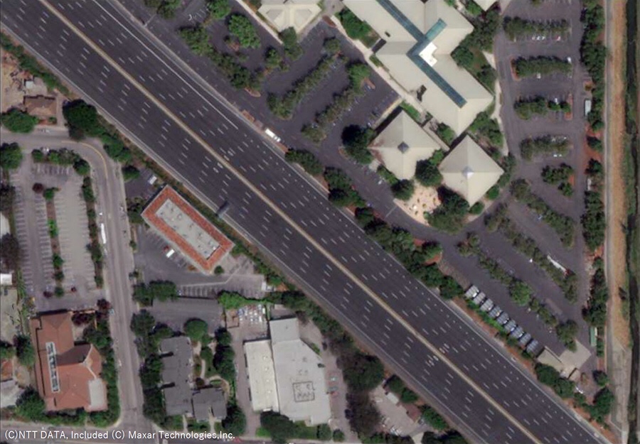
Figure 2. Removal and image correction of cars, etc.
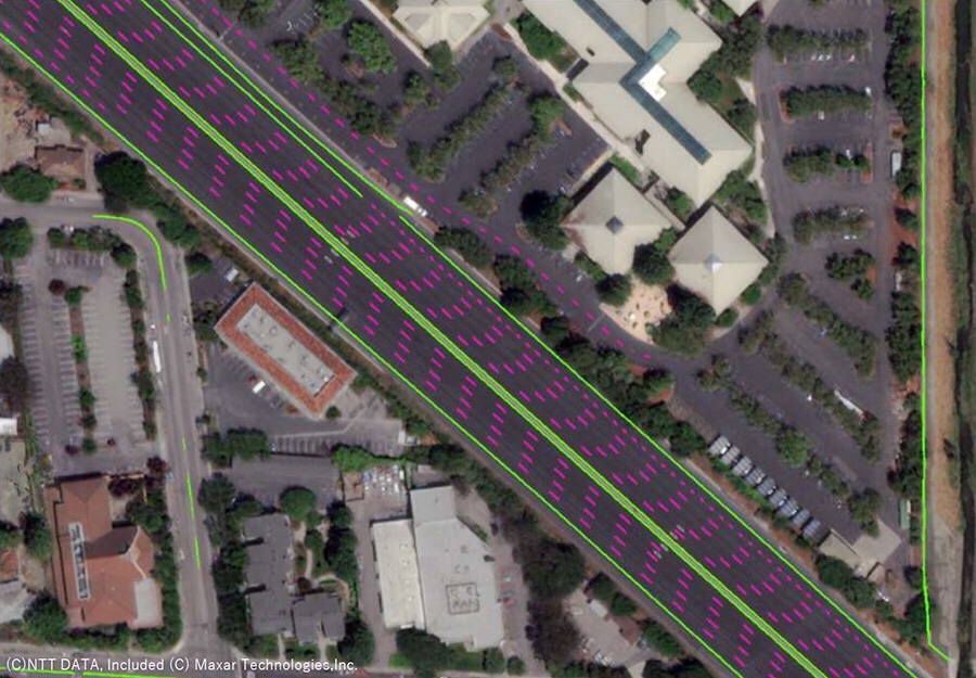
Figure 3. Map information extraction
Toyota: TRI-AD
In the past, high-precision mapping was costly, making it difficult to cover a wide area.
TRI-AD researches effective methods for creating high-precision maps of motorways.
Motorways: High-precision mapping
A demonstration experiment was conducted with several partners.
As a result, it was confirmed that a map with a relative accuracy of about 50 cm or less required for automatic driving can be generated.
Maxar Technologies / NTT Data / TRI-AD
From April 25, 2019, the three companies jointly conducted a “test for automatic generation of high-precision maps for automatic driving using high-resolution / satellite images”.
This demonstration experiment:
The following points were verified and confirmed to be useful for high-accuracy map generation.
Generates autonomous driving / map information from satellite and general vehicle image data without using dedicated measurement vehicles,
Convert to TRI-AD / Automated Mapping Platform (AMP) data format,
If the algorithm is corrected, of course, it can be used on other platforms.
Global Newsroom | TOYOTA