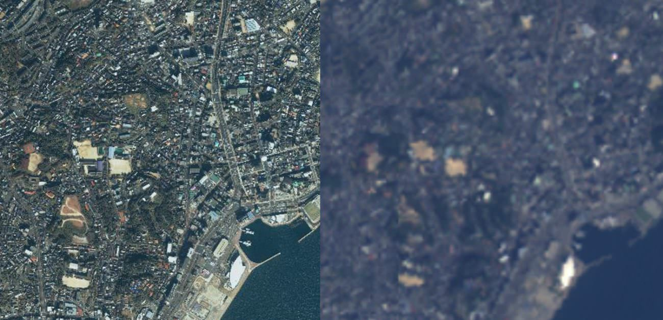
To the left: an IKONOS image (resolution: 3 m) and to the right: an AVNIR-2 image (resolution: 10 m). There is a difference in resolution of over three times between these, with different color variations.Credit : JAPAN SPACE IMAGING CORPORATION (left) JAXA (right)
Tellus: Free Tellus-Clairvoyant: High resolution satellite imagery
-Utilizing super-resolution technology “Tellus-Clairvoyant”-
Tellus-Clairvoyant:
On October 21, 2021, we started providing software for free.
This tool was developed by Sakura Internet with the cooperation of Sharp Corporation, utilizing super-resolution technology.
sharp
Sakura Internet
Performs super-resolution processing using a deep learning model.
Of the satellite data of AVNIR-2 and PALSAR-2,
Double or quadruple resolution,
I was able to expand it in a pseudo manner.
Sakura Internet:
With the cooperation of Sharp
To improve the visibility of satellite data
Developed super-resolution technology for satellite data,
This time, we have provided a tool.
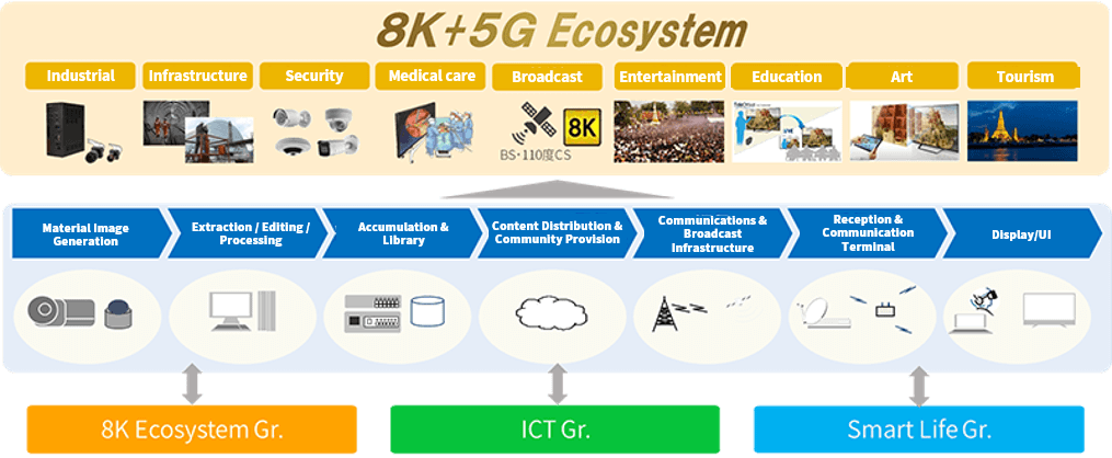
Space industry:
Recently, the release of government satellite data is progressing.
However, the resolution of government satellite data released free of charge is only about 10m.
News & Topics | Tellus
Super-resolution processing of satellite images using Sharp’s original deep learning model | Sorahata
Super-Resolution Processing of Satellite Images Using Sharp’s Deep Learning Model
The Sharp Corporation
is a participant in the xData Alliance, working together with Sakura Internet to make progress in satellite data application.
This article looks at satellite super-resolution imagery made with machine learning as a part of the framework for the alliance.
Super-resolution is a technique to artificially raise the resolution of an image.
Super-resolution
is one of the hot topics in the field of machine learning, but what happens when you combine it with satellite imagery?
We went to the Sharp Corporation (referred to below as “Sharp”) Research and Development HQ,
asked the manager of the 3rd Research Team for Communication & Image Technology Laboratories,
Tomohiro Ikai, and researcher, Eiichi Sasaki about the future of this technology.
Sorabatake
https://sorabatake.jp/en/12973/
【Tellus-Clairvoyant(ADIN)】
【Tellus-Clairvoyant(API)】