Satellite image: Japan JAEA, radiation dose distribution measurement – “3D-ADRES” development
Developed a computing system “3D-ADRES” that enables estimation of detailed dose distribution
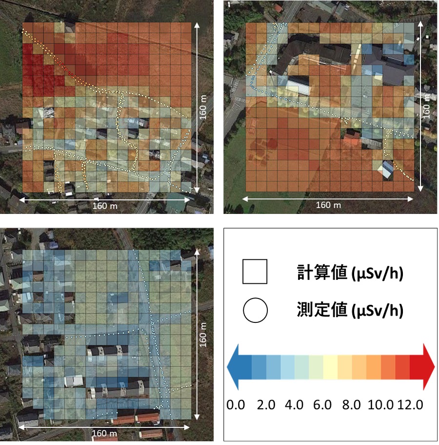
The 3D Air Dose Rate Evaluation System (abbreviated 3D – ADRES) uses a satellite image and the like to realistically model complex urban areas and forests and measures the detailed three – dimensional distribution of radiation dose.
In fact, radiation doses were calculated in three areas with different characteristics (Okuma Town and Tomioka Town, etc.), and almost all of them coincided with the measurement results, indicating the validity of the calculation.
Japan Atomic Energy Agency: Press announcement