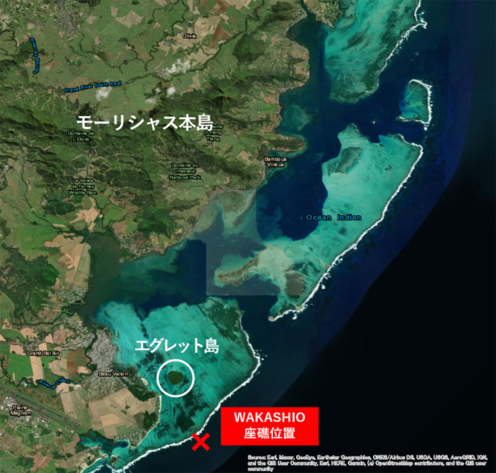
Figure 1. Location of Mauritius and stranded vessels
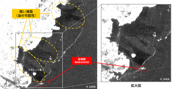
Figure 2. August 10 11:36 (local time) Off-nadir angle 35.2° Wide area observation mode (resolution 100m)
You can see the oil flowing from the stranded ship to Mauritius main island via Egret Island. You can also see the places that seem to be oil on the upper (north) coast of the image.
JAXA: “Daichi 2” observation cooperation: Mauritius oil spill accident
Mauritius oil spill:
On July 26, a cargo ship “WAKASHIO” stranded on the coast of the Republic of Mauritius, causing an oil spill.
On August 6, Japan’s International Emergency Relief Team and expert team were dispatched to carry out oil control work and support activities in the environmental field.
JAXA observation image:
In order to cooperate with this activity, JAXA conducted an emergency observation off the coast of Mauritius using the Land Observing Satellite-2 “Daichi-2” (ALOS-2).
We provide observation data (images) and provide technical support to the Japan Coast Guard, which participates in the Japan Emergency Relief Team and expert team.
Japan Coast Guard: Analysis
“Daichi 2” observation data is analyzed by the Japan Coast Guard and is used by the International Emergency Relief Team and a team of experts (primary team).
We will continue to provide the observation data of “Daichi 2” to the currently active secondary squad.
Results of observation data analysis:
The oil spill area was observed to have narrowed on August 14 compared to August 10.
On August 15, it became an observation image as if the oil range had expanded again.
The range of oil narrowed again on the 17th, and the same trend has continued since then.
In addition, it was often observed that the oil flow from the stranded ship went to Mauritius main island via Egret Island.
Obtaining tide information:
According to the tidal current information based on multiple satellite data, the east offshore of Mauritius main island is facing east to west after August 1, and we think that it was influenced by the tidal current.
JAXA: First Space Technology Division Earth Observation Research Center (EORC)