JAXA: Monitoring infrastructure displacement with satellites: Call for ANATIS users
JAXA: Developed ANATIS
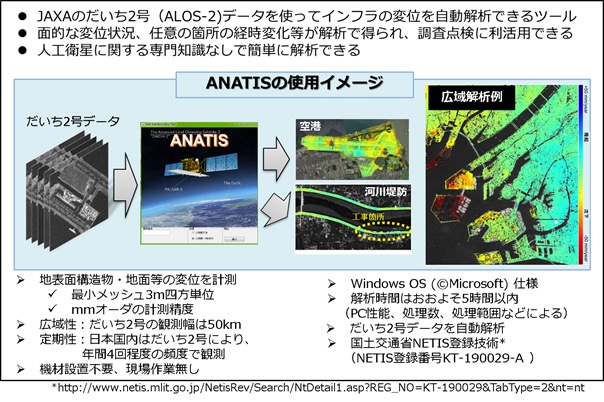
JAXA has developed a tool that can monitor infrastructure displacement using satellite data.
That was the development of ANATIS.
ANATIS: Observation data of “DAICHI-2” (Figure 1)
The displacement of the infrastructure can be automatically analyzed using the observation data of the land observation technology satellite “DAICHI-2” (ALOS-2) * 2.
With this, you can monitor the infrastructure using satellite data, even if you do not have specialized knowledge about satellites.
This time, we decided to “publicly recruit companies that will spread ANATIS to society and make use of it”.
Application conditions: ANATIS sales
Businesses that meet the application conditions are allowed to use the software for commercial purposes (ANATIS is sold, solution service).