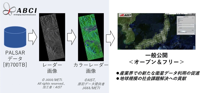
Figure 1 Colorization of radar image on ABCI
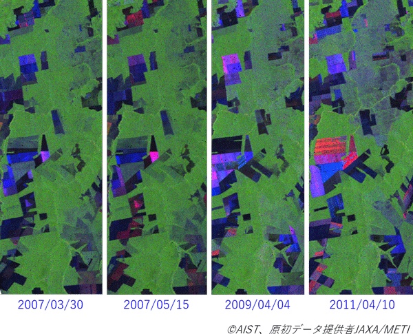
Figure 2 Deforestation in South America
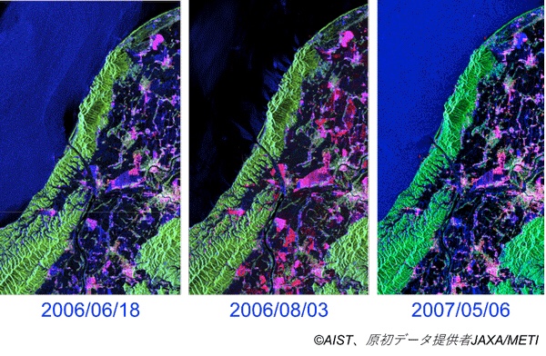
Figure 3 Time series changes of rice cultivation in Echigo Plain
AIST: Colorized and released satellite images: PALSAR / Global observation data utilization
AIST:
-Create a color-coded image according to the condition of the ground surface on a global scale so that it can be understood at a glance-
Development summary:
ABCI processes all PALSAR data images and releases color radar images showing the state of the ground surface
Publish with open & free policy, reduce barriers to entry for satellite data utilization
Solving global social issues by utilizing the advantage of satellite data called global observation
Development history:
AIST and Tokyo Institute of Technology open open innovation laboratory utilizing big data in the real world.
System development using ABCI, a computer for artificial intelligence processing.
Image processing is performed on all SAR data acquired by the satellite microwave sensor PALSAR.
Create a color radar image that is color-coded according to the condition of the ground surface for the entire world.
Open and free policy (CC BY) published on the following sites.
https://gsrt.airc.aist.go.jp/landbrowser/index.html
This time, using ABCI,
For 5 years and 3 months (January 2006 to April 2011),
Image processing of all PALSAR data (about 2 million scenes, 700 TB),
The practicality was evaluated from the viewpoint of image processing time and image quality.
Furthermore, in order to analyze the state of the ground surface in detail, in the data acquired in 4 polarization mode,
SAR data analysis method / scattered power decomposition,
Color coding is performed according to the condition of the ground surface,
Create a color radar image,
It is shown that the time series change of the ground surface over a wide area can be easily understood.
SAR satellite:
It can be observed even at night or during rainfall, and it can regularly acquire surface information from around the world.
This time, we created and released a color radar image that makes it easy to identify and recognize objects and changes on the ground surface.
Large-scale illegal logging monitoring
Rice production control over a wide area,
Global fisheries management,
Infrastructure conservation,
It can be expected to contribute to the solution of global social issues.
https://www.aist.go.jp/aist_j/press_release/pr2020/pr20200522/pr20200522.html
About LandBrowser | Research Team | Artificial Intelligence Research Center