terradrone: Green laser, shallow survey start-construction consulting and survey company
We have already received consultations with vertical surveying projects such as rivers from construction consulting and surveying companies.
We will develop measurement in various parts of the country.
Conventional bathymetry: Manned airborne multi-beam
The mainstream approach is to use a manned airborne green laser and a multi-beam onboard ship.
However, it took a lot of time and a lot of money to measure.
This time’s survey: Drone-mounted green laser
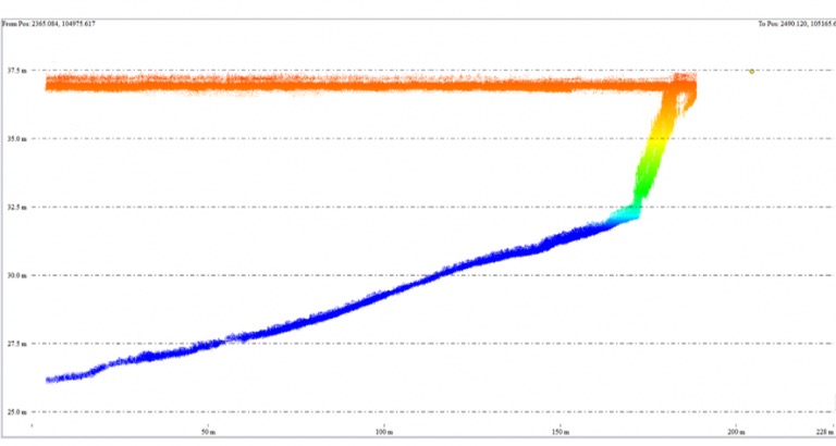
Sounding measurement of dams that are difficult for ships
Survey of the current status of structures,
When disasters occur in rivers and beaches,
Investigation for design before embankment / erosion control plan,
Maintenance after construction
It achieves labor savings and high accuracy in measurement surveys and maintenance.
In this demonstration, we conducted water quality surveys using ortho images, transparency comparisons, and water quality turbidity meters.
Accuracy comparison:
We compared the accuracy with the conventional ground survey and near infrared UAV laser.
Also on land coordinate information, we confirmed the same accuracy as the conventional method.
Terra drone corp. | Terradrone japan
https://www.terra-drone.net/blog/page-6189/?utm_source=rss&utm_medium=rss&utm_campaign=page-6189