Chinese Fleet Encroaches on the Galápagos Islands
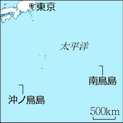
Japan: AI monitors borders and remote islands: Minamitorishima, Okinotorishima
Ministry of Land, Infrastructure, Transport and Tourism:
Minamitorishima, the easternmost point in Japan,
At Okinotorishima, the southernmost tip of Japan
AI will be used for port facility management and monitoring of the surrounding sea area.
AI analysis of satellite images:
AI analysis of satellite images taken of two islands (Minamitorishima and Okinotorishima).
The policy is to introduce it next year.
Exclusive Economic Zone / EEZ Conservation:
The two islands are the borders of Japan and the base points of the EEZ.
It is necessary to conserve the island in order to maintain maritime interests.
New monitoring system:
Image data around Futajima is acquired from a private artificial satellite.
When AI analysis is performed and an abnormality in the facility is detected,
Automatically notify the department in charge of the Ministry of Land, Infrastructure, Transport and Tourism.
From this year, AI discrimination basic data will be created.
Surveillance of illegal operations and smuggling:
Link satellite images with ship AIS (Automatic Identification System).
AI analyzes “Are there any suspicious movements such as illegal operations or smuggling?”
We plan to detect it early and take prompt action.
Yomiuri Shimbun Online
https://www.yomiuri.co.jp/national/20210906-OYT1T50153/
Potential Chinese illegal Fishing Seen from Space – HawkEye 360
https://www.he360.com/insight/potential-illegal-fishing-seen-from-space/