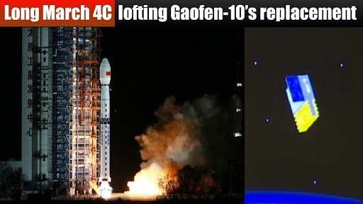
China launches satellite that can photograph every metre of ground
The Chinese satellite, Gaofen-10,
was launched at 2:51 a.m. Saturday (Beijing Time) aboard a Long March-4C rocket and entered the planned orbit successfully.
It was the 314th flight mission of the Long March carrier rocket series.
As part of the country’s high-definition Earth observation project, the microwave remote sensing satellite
is capable of providing photographs with a ground-level resolution of less than a metre.
Gaofen-10
will be used in land survey, urban planning, road network design, crop yield estimate, as well as disaster relief.
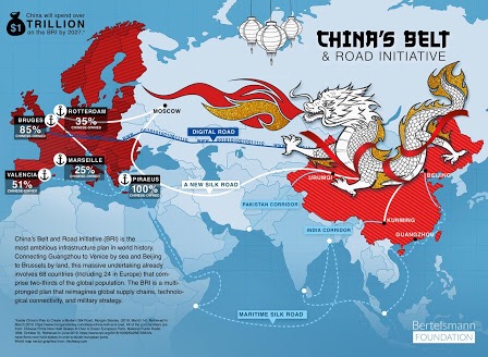
It can also serve key national strategies such as the Belt and Road Initiative.
Euronews