Japan · NTTD: Narita airport, high precision · Airport guide service launch – 2.5D map realized!
In collaboration with Narita International Airport (NAA), NTT DATA will release “NariNAVI” (air navigation application: available at Narita International Airport Terminal) on September 20, 2018.
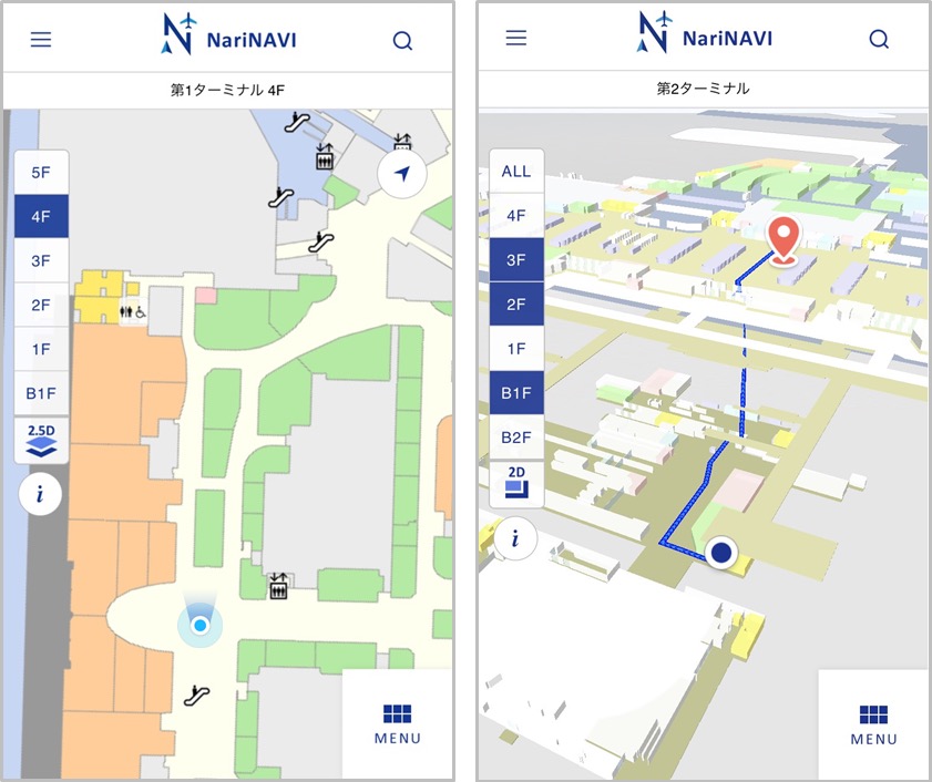
NariNAVI displays the current position on the airport map on the smartphone in real time by geomagnetic positioning.
The user can grasp the current position in real time.
In the map display, in addition to the usual 2D map, we realized a 2.5D map that three-dimensionally expresses complex airport facilities that span multiple floors.
For foreign nationals visiting Japan, we intuitively support easy-to-understand airport guidance.
NTT DATA