JAXA: NEC realizes GPS navigation in geosynchronous orbit: capture / tracking / decoding of weak signals
-Developed “GPS receiver for geostationary satellite”-
JAXA
NEC
NEC Space Technologies:
GPS signals from GPS satellites are used to determine the time / position / speed of satellites with high accuracy.
This time, for the first time in Japan, GPS navigation has been realized in geosynchronous orbit.
Achieve GPS navigation in geosynchronous orbit:
This will
Efficiency of autonomous navigation and orbit control operation,
Improved geometric correction accuracy of satellite images,
Higher time-based accuracy of satellite-mounted systems, etc.
This will contribute to a significant improvement in the capabilities of geostationary satellites.
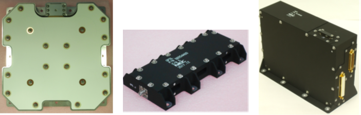
“GPS receiver for geostationary satellite”:
Developed jointly by JAXA and NEC.
It uses technology that enables the acquisition / tracking / message decoding of weak GPS signals.
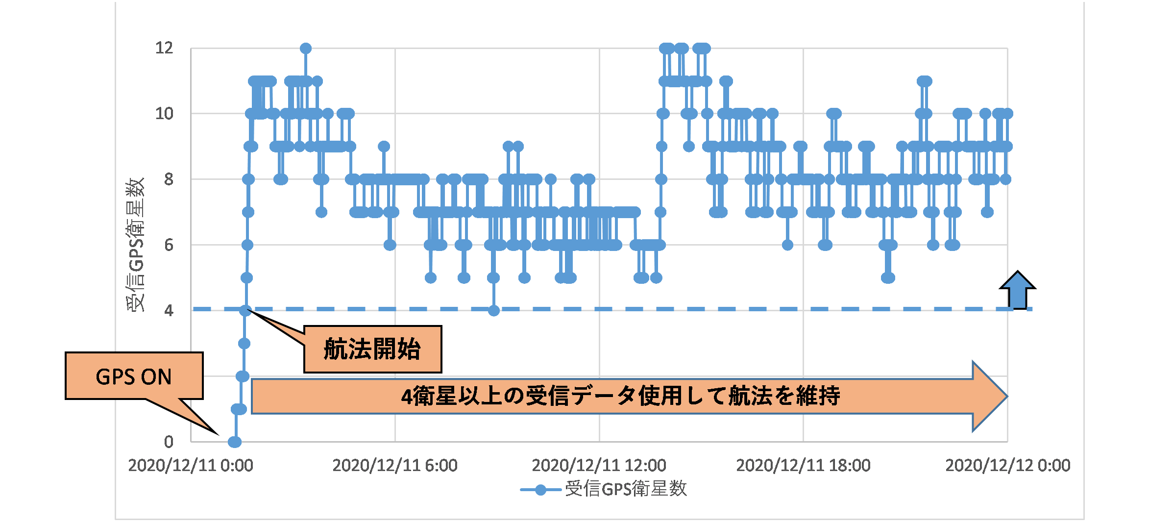
This time in orbit on a geostationary satellite
Receive GPS signals from 4 or more GPS satellites,
It was confirmed that stable GPS navigation could be continued.
NEC Space Technologies:
At NEC Space, he is in charge of developing / manufacturing / selling this receiver.
Based on these R & D results, sales will begin in Japan and overseas from the spring of 2021.
ZDNet Japan
https://japan.zdnet.com/article/35166823/
JAXA and NEC realize Japan’s first GPS navigation in geosynchronous orbit
-Using GPS receivers for geostationary satellites equipped with optical data relay satellites-
Traditional GPS navigation
GPS navigation has been widely used so far.
Highly accurate orbit determination for low earth orbit satellites,
Higher accuracy of time reference of satellite-mounted system,
For operational efficiency improvement by autonomous orbit control, etc.
Use of GPS navigation on geostationary satellites:
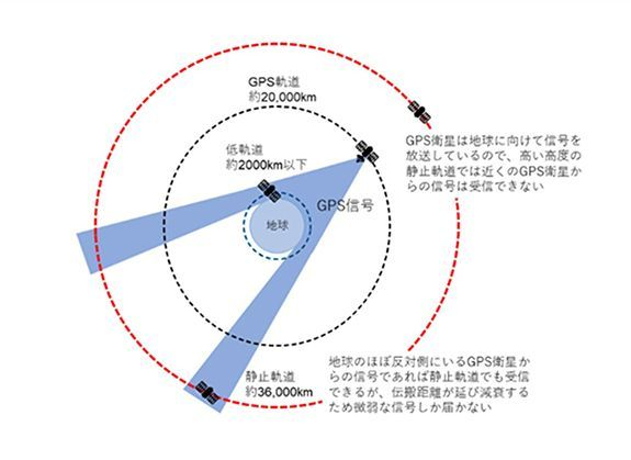
However, conventional GPS satellites send GPS signals toward the surface of the earth.
Weak GPS signals arrive from geostationary satellites located at higher altitudes (36,000 km) than GPS satellites from distant GPS satellites on the opposite side of the earth (reference figure).
However, the use of GPS navigation on geostationary satellites has not been widespread because it is difficult to capture this weak GPS signal.
This receiver:
Developed jointly by JAXA and NEC.
We use technology that enables the acquisition, tracking, and message decoding of weak GPS signals.
GPS signals in orbit on geostationary satellites
Received from 4 or more GPS satellites,
Being able to continue stable GPS navigation,
We have confirmed the technology that enables the acquisition / tracking / message decoding of weak GPS signals (Fig. 2).